| Description |
-
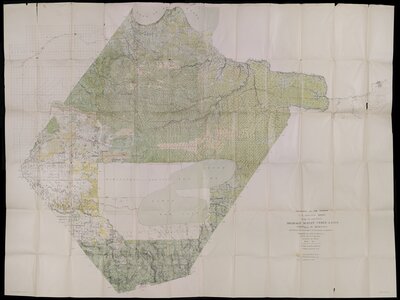
Shows drainage, public land, existing and proposed main ditches, timber areas, and diminished Red Lake Indian Reservation.
Covers vicinity of Red Lake; west to Thief River, east to International Falls, north to Lake of the Woods, and south to Copley Township in Clearwater County.
Relief shown by contours; contour interval 10 ft.
W.H. Herron, geographer; Topography by ... read moreAlfred P. Meade, Jr.; Control by E.L. McNair.
This image is a digital composite made from several exposures to capture the full extent of the object.read less
|
|---|
This object is in collection